
GPS location data
GPS Question
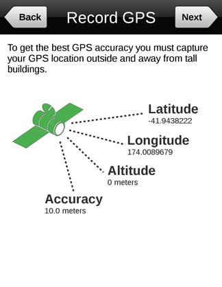
The GPS Question type displays the longitude, latitude, altitude and location accuracy of a respondent's mobile device. It has been designed for users who need to collect highly accurate GPS data at a specific stage within their survey.
The GPS on a mobile device is not as accurate as a dedicated GPS. To get the best GPS accuracy, we recommend respondents capture their GPS location outside and away from tall buildings.
This question type can be set up with a specified accuracy level that the respondent must reach before they can continue to the next question. The GPS location and accuracy is displayed to the respondent in real time. The accuracy status is visually represented by the GPS icon flashing red when there is inadequate accuracy through to amber and finally green when the minimum required accuracy level is reached.
The GPS question is currently supported on Android devices only. It is ideal for projects where the data collector needs to view the GPS data within the survey.
Note: A survey can be set up to capture the GPS location on iOS devices. However this option captures the GPS data at the end of the each survey rather than at a specific point within the survey. It also captures the GPS data in the background and the respondent does not see the longitude, latitude, altitude and accuracy data during the survey.